The Red Sea is not just water between continents. It is where trade, war, ports, energy, and recognition politics now collide.
The Geography of Power
Why the Red Sea Has Become the World’s Most Dangerous Waterway
Strategic Intelligence Assessment
Geography rarely explains everything in international politics, but it often explains where pressure will concentrate first.
The Red Sea has become one of those places.
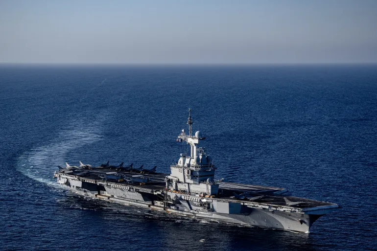
For decades, the waterway was treated by much of the outside world as a corridor between more important theaters: Europe, the Middle East, Africa, and Asia. Ships passed through it. Energy moved through it. Military vessels patrolled it. Yet the Red Sea itself was often viewed as a route rather than a strategic arena.
That assumption has collapsed.
The Red Sea is no longer merely a passageway. It is now a contested zone where global trade, regional wars, great-power rivalry, energy security, and the future of African ports intersect.
The strategic reason is simple.
Narrow waterways create global vulnerability.
The Red Sea connects the Indian Ocean to the Mediterranean through the Bab el-Mandeb Strait and the Suez Canal. The IMF has noted that the Suez route normally carries about 15 percent of global maritime trade, making it one of the most important commercial arteries on earth.
When attacks in the Red Sea disrupted shipping, major companies diverted vessels around the Cape of Good Hope, adding time, cost, fuel consumption, insurance exposure, and operational uncertainty.
This is why geography becomes power.
A relatively small armed group operating near a chokepoint can impose costs on shipping companies, insurers, consumers, and governments thousands of kilometers away. The effect is disproportionate. The actor may be local, but the consequences are global.
That is the defining lesson of the Red Sea crisis.
The Houthis did not need a blue-water navy to disrupt global commerce. They used missiles, drones, maritime threats, and political messaging to challenge one of the world’s most important trade corridors.
Reuters reported in June 2026 that the group again threatened Israeli maritime navigation in the Red Sea, while shipping sources warned that uncertainty over vessel affiliation could produce wider effects because many commercial operators may choose the longer route around Africa rather than risk miscalculation.
The Red Sea therefore demonstrates a central principle of modern conflict.
Strategic disruption no longer requires strategic parity.
A weaker actor can pressure stronger states by targeting systems those states cannot afford to lose: shipping lanes, ports, cables, fuel routes, insurance markets, and public confidence.
This is why the Red Sea has become more dangerous than its geography alone suggests.
It is not only the waterway that matters. It is the concentration of interests around it.
To the north sits the Suez Canal, a pillar of Egypt’s economy and one of the great arteries of global trade. To the south sits Bab el-Mandeb, the narrow gateway between Yemen, Djibouti, Eritrea, Somaliland, and the wider Indian Ocean.
To the east lie the Gulf states, Iran, Israel, and the energy routes that shape global markets. To the west lie African states whose ports, coastlines, and political alignments are becoming increasingly important to external powers.
This is not a single crisis.
It is a convergence.
The World Bank has described the Red Sea crisis as a critical flashpoint of the Middle East conflict, affecting global trade, maritime transport, regional port activity, and the ecological balance of the Red Sea.
UN Trade and Development has separately warned that disruptions at maritime chokepoints are straining supply chains, raising costs, reshaping trade patterns, and hitting vulnerable economies hardest. For policymakers, this creates a difficult reality.
The Red Sea cannot be secured only at sea.
Diplomatic agreements may calm one front, but they do not remove the structural vulnerability created by chokepoints.
This makes the Red Sea a test case for twenty-first-century security.
The threats are layered.
There is the military threat from missiles, drones, mines, and armed vessels.
There is the economic threat from insurance costs, rerouting, delayed cargo, and canal revenue losses.
There is the political threat from proxy warfare, state rivalry, and contested recognition.
There is the informational threat from propaganda, psychological pressure, and narratives designed to portray disruption as strategic victory.
All of these threats interact.
This is why the Red Sea is now central to Somaliland’s strategic future.
For Somaliland, geography is not background. It is destiny.
Berbera sits on the Gulf of Aden, facing one of the world’s most sensitive maritime corridors. DP World describes Berbera Port as a deep-water facility with advanced cargo handling and port-centric logistics linked to the Berbera Economic Zone, while also operating a shipping route connecting Berbera with Jebel Ali, Aden, and Djibouti.
That position creates opportunity.
It also creates exposure.
A stable port near an unstable maritime corridor becomes valuable precisely because instability increases demand for reliable alternatives. But the same value can attract political pressure, intelligence interest, economic competition, and strategic suspicion from rival actors.
This is the paradox of maritime geography.
The closer a country is to a vital chokepoint, the more valuable it becomes. The more valuable it becomes, the more pressure it attracts.
Somaliland’s role in the Red Sea must therefore be understood through a wider strategic lens. Berbera is not simply a port. It is a potential logistics platform, economic gateway, diplomatic asset, and security variable in a region where every kilometer of coastline carries increasing geopolitical weight.
That does not mean Somaliland should fear its geography.
It means Somaliland must manage it with strategic discipline.
The countries that benefit most from chokepoint politics are not necessarily those with the largest navies. They are those with stable institutions, credible partnerships, disciplined diplomacy, and the ability to convert location into leverage without becoming a proxy battlefield for others.
This distinction is critical.
Geography gives a state position.
Statecraft determines whether that position becomes power or vulnerability.
The Red Sea will remain contested because the forces driving competition are structural. Global trade will continue to depend on maritime corridors. Middle Eastern conflicts will continue to project into surrounding waterways.
Great powers will continue to seek access, influence, and surveillance capacity. Regional states will continue to use ports, bases, and logistics networks as instruments of diplomacy.
None of this is temporary.
The Red Sea has entered a long strategic cycle.
For WARYATV Intelligence, the key assessment is that the Red Sea should no longer be analyzed as a shipping route alone. It must be treated as a geopolitical system linking ports, wars, energy markets, recognition politics, and great-power competition.
In that system, Somaliland is not peripheral.
It is geographically exposed, economically relevant, and increasingly visible.
Strategic Assessment: The Red Sea has become dangerous not because one conflict controls it, but because many conflicts now pass through it. Geography has turned a maritime corridor into a pressure point for global trade, regional power, and African statecraft.
The states that understand this early will shape the next phase of Red Sea politics; those that do not will be shaped by it.
Hormuz was the warning. Bab el-Mandeb could be the escalation
Red Sea Militarization Grows — Ethiopia Warns of Strategic Encirclement by Egypt
Somaliland and Puntland Crack Down on Iranian Illegal Fishing Fleets in the Gulf of Aden